Current Conditions
♦
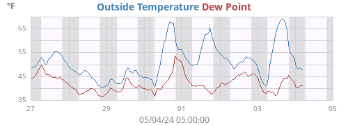
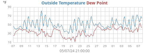
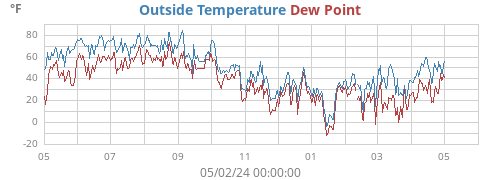
| Outside Temperature | 78.2°F |
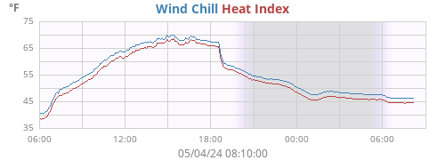
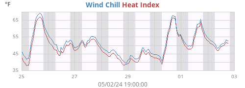
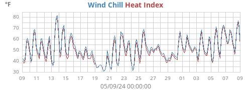
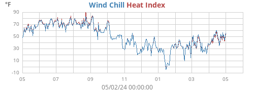
| Heat Index | 79.2°F |
| Wind Chill | 78.2°F |
| Dew Point | 69.2°F |
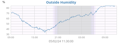
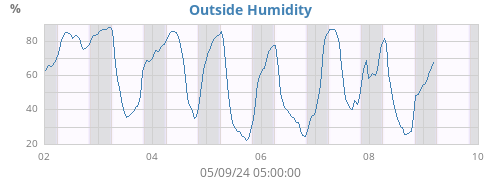
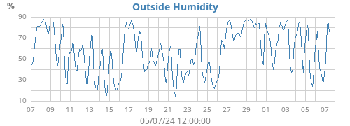
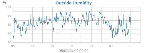
| Outside Humidity | 74% |
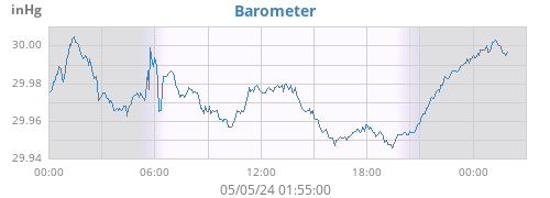
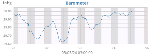
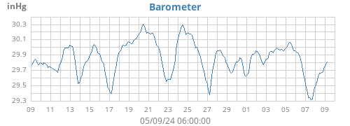
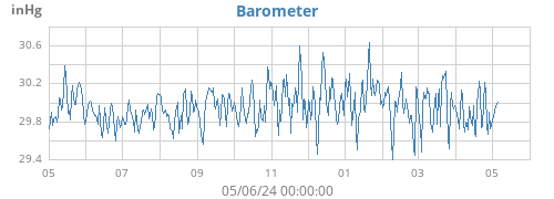
| Barometer | 29.865 inHg (-0.022) |
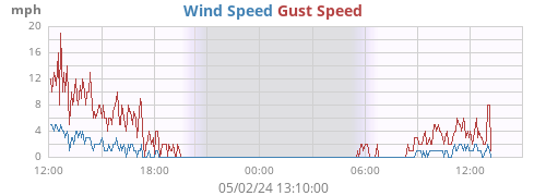
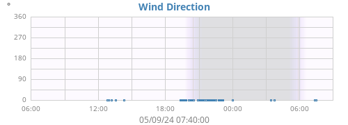
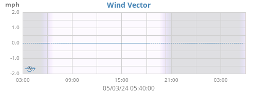
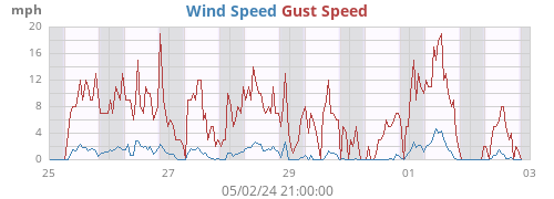
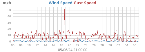
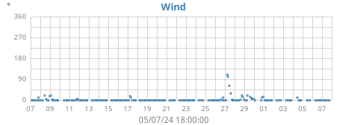
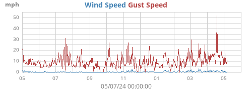
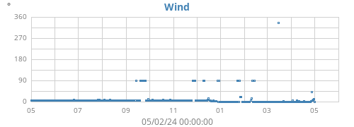
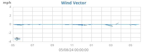
| Wind | 1 mph SE (135°) |
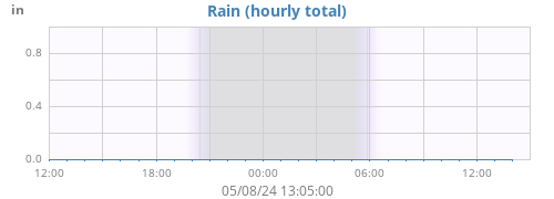
| Rain Today | 0.00 in |
| Rain Rate | 0.00 in/h |
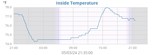
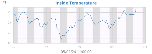
| Inside Temperature | 74.3°F |
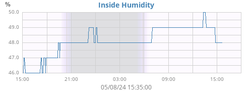
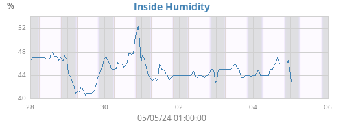
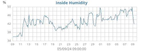
| Inside Humidity | 50% |
| ☀ | ☽ | |||
|---|---|---|---|---|
| Rise | 05:53:10 | Rise | 23:55:54 | |
| Set | 20:46:07 | Set | 13:36:42 | |
| Daylight | 14:52 | Last quarter 56% |
| Today |
Week |
Month |
Year |
Rain Year |
||
|---|---|---|---|---|---|---|
| Outside Temperature |
78.5 72.2 |
88.5 56.0 |
92.5 53.1 |
92.5 -7.5 |
92.5 -7.5 |
°F |
| Heat Index |
79.4 73.1 |
94.8 55.4 |
98.6 51.8 |
98.6 -7.5 |
98.6 -7.5 |
°F |
| Wind Chill |
78.5 72.2 |
88.5 56.0 |
92.5 53.1 |
92.5 -28.5 |
92.5 -28.5 |
°F |
| Dew Point |
69.5 67.2 |
71.7 52.2 |
72.2 38.4 |
72.8 -14.5 |
72.8 -14.5 |
°F |
| Outside Humidity |
85 71 |
89 41 |
90 31 |
90 11 |
90 11 |
% |
| Barometer |
29.897 29.864 |
30.211 29.850 |
30.232 29.610 |
30.727 29.216 |
30.727 29.216 |
inHg |
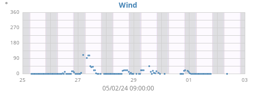
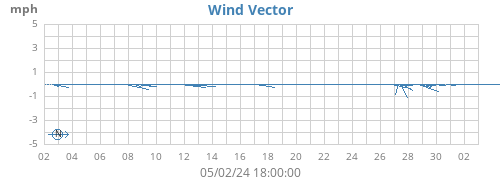
| Max Wind |
7 135 |
14 225 |
17 292 |
78 270 |
78 270 |
mph ° |
| Average Wind | 0 | 0 | 0 | 0 | 0 | mph |
| RMS Wind | 1 | 1 | 1 | 1 | 1 | mph |
|
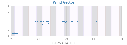
Vector Average Vector Direction |
0 167 |
0 160 |
0 246 |
0 358 |
0 358 |
mph ° |
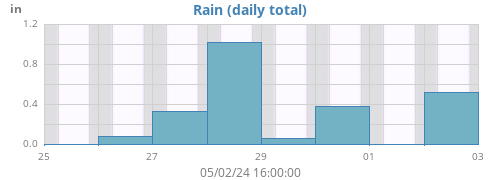
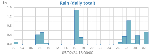
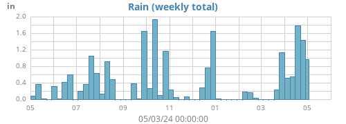
| Rain | 0.00 | 0.46 | 1.75 | 20.36 | 20.36 | in |
| Rain Rate | 0.00 | 8.11 | 8.11 | 655.35 | 655.35 | in/h |
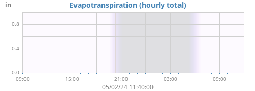
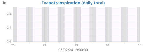
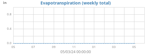
| Evapotranspiration | 0.00 | 0.00 | 0.00 | 0.00 | 0.00 | in |
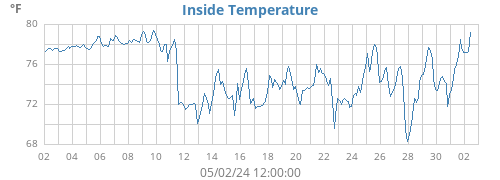
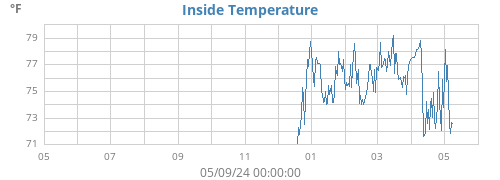
| Inside Temperature |
75.7 73.8 |
77.9 70.6 |
79.7 69.2 |
84.9 67.4 |
84.9 67.4 |
°F |
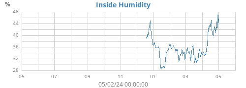
| Inside Humidity |
51 47 |
57 45 |
59 44 |
60 27 |
60 27 |
% |
| Connectivity | ||
|---|---|---|
| Signal Quality | 77% | |
| Battery Status | ||
| Transmitter Battery | OK | |
| Voltage | ||
| Console Battery | 4.5 V |
About this station
♦
| Hardware | Vantage Pro2 |
| Latitude | 45° 11.29' N |
| Longitude | 093° 22.08' W |
| Altitude | 873 feet |
| Server uptime | 31 days, 13 hours, 29 minutes |
| WeeWX uptime | 31 days, 13 hours, 29 minutes |
| WeeWX version | 5.0.2 |
| Skin | Seasons 5.0.2 |